Map of forest fire area by fire frequency
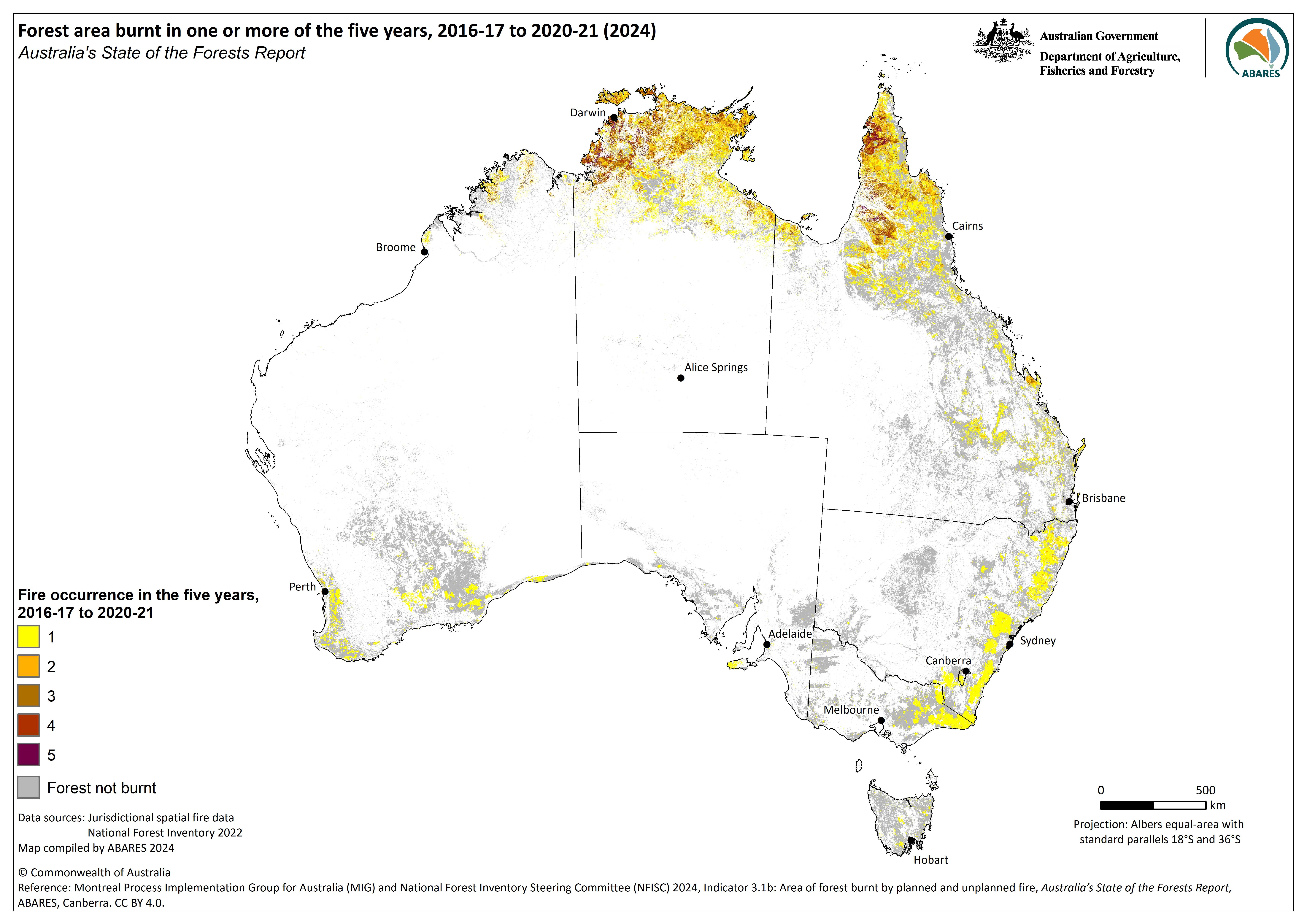
Map of the Fires in Australia's forests 2016–21 (2024) dataset showing extent of fires in Australia's forests, by number of fires.
Source
This data file or API can be downloaded from:
https://data.gov.au/data/dataset/2b62f9a3-50c5-4928-bc4a-3f3ab2810a34/resource/4ec2b56d-0796-47e5-8551-b817fe55165c/download/fire_in_forests_2016_21_frequency.pngResources
Additional Information
| Field | Value |
|---|---|
| Data last updated | November 12, 2024 |
| Metadata last updated | November 28, 2024 |
| Format | PNG |
| License | Creative Commons Attribution 4.0 International |
| Datastore active | False |
| Datastore contains all records of source file | False |
| Has views | True |
| Id | 4ec2b56d-0796-47e5-8551-b817fe55165c |
| Mimetype | image/png |
| Package id | 2b62f9a3-50c5-4928-bc4a-3f3ab2810a34 |
| Position | 3 |
| Size | 1.7 MiB |
| State | active |
| Url type | upload |
| Zip extract | False |
| Size | 1.7 MiB |
| ID | 4ec2b56d-0796-47e5-8551-b817fe55165c |
| Harvested | False |
| Package ID | 2b62f9a3-50c5-4928-bc4a-3f3ab2810a34 |
| State | active |