Map of the Indigenous forest estate
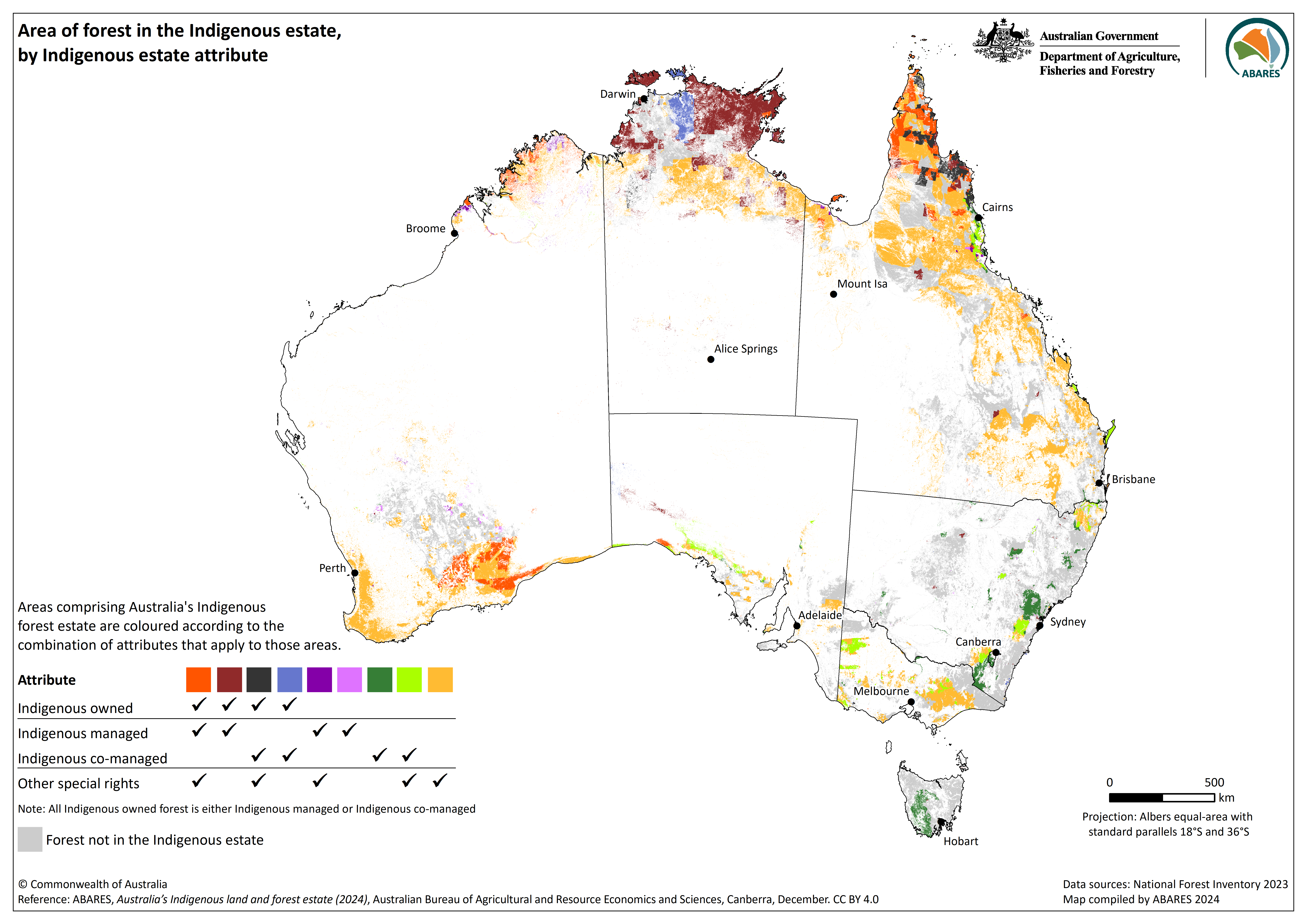
Static map of the Indigenous forest estate component of the Australia's Indigenous land and forest estate (2024) dataset. This map shows the combination and overlap of attributes of the Indigenous estate combines with the forest cover and forest type information for the Forests of Australia (2023) spatial dataset, available at: https://www.agriculture.gov.au/abares/forestsaustralia/forest-data-maps-and-tools/spatial-data/forest-cover.
Source
This data file or API can be downloaded from:
https://data.gov.au/data/dataset/107db6e8-0b8e-402e-8ecf-39c632efa180/resource/d856df99-3b3a-40fd-b5dd-fdf17a32e7d1/download/indig_forest_estate_dataset_map.pngResources
Additional Information
| Field | Value |
|---|---|
| Data last updated | November 11, 2024 |
| Metadata last updated | November 28, 2024 |
| Format | PNG |
| License | Creative Commons Attribution 4.0 International |
| Datastore active | False |
| Datastore contains all records of source file | False |
| Has views | True |
| Id | d856df99-3b3a-40fd-b5dd-fdf17a32e7d1 |
| Mimetype | image/png |
| Package id | 107db6e8-0b8e-402e-8ecf-39c632efa180 |
| Position | 7 |
| Size | 1.5 MiB |
| State | active |
| Url type | upload |
| Zip extract | False |
| Size | 1.5 MiB |
| ID | d856df99-3b3a-40fd-b5dd-fdf17a32e7d1 |
| Harvested | False |
| Package ID | 107db6e8-0b8e-402e-8ecf-39c632efa180 |
| State | active |